
Hats
The Sun-Smart Collection

Bags
Transport In Style

Shoes
Comfort X Design
Hats
The Sun-Smart Collection
Bags
Transport In Style
Shoes
Comfort X Design
SCENES-1 List
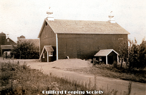
P-3502.
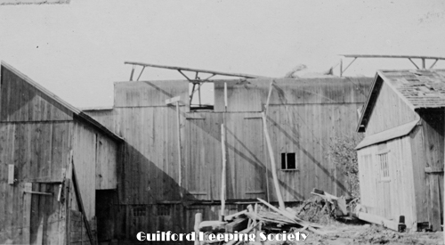
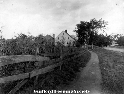
Barn at Hillcrest Farm Clapboard Hill. The barn was moved in 1941 by Paul Dudley and Berton Chalker from Henry S. Davis property on #320 Boston Street. It was originally 30 x 42 feet. An addition of 12 feet was added to one end. Taner Marsh Rd HENRY S. DAVIS?
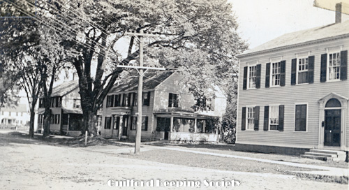
P-3508.
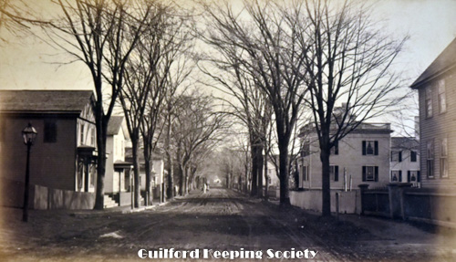
State St Henry Chamberlain’s Merle Jillson’s Mrs. Bristol’s Right – left #1 Samuel Eliot house 1803, #7 Friend Collins 1787 and #15 John Davis 1784 Looking north on State St at Broad St c1925 ALBERT D. HOTCHKISS.
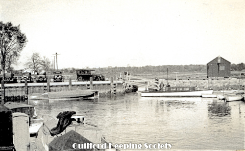
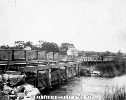
P-3511.
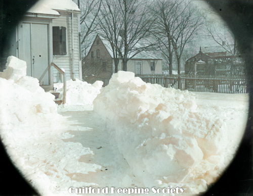
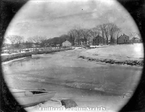
Sluice basin Guilford. Old Hudson at end of line. May 13, 1934, ALBERT D. HOTCHKISS
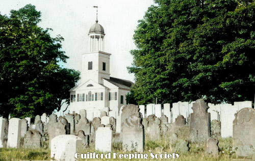
P-3514.
North Guilford Church SHELTON W. DUDLEY.
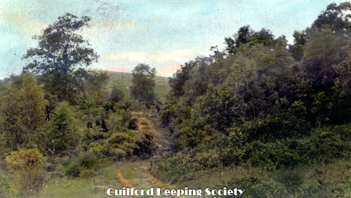
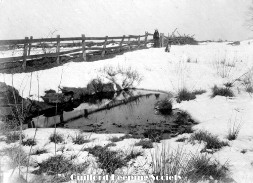
P-3517.
Last trip in West Woods-Marsh Rd near Marsh Rd Ledges Spring 1939 BEATRICE OLVER.
P-3520.
West Woods near Marsh Rd Ledges Spring 1939 BEATRICE OLVER.
P-3523.
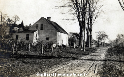
North Guilford School House Charles Hubbard taught drawing here as a young man 1918-1920 Located on County Rd #730 County Rd
P-3527.
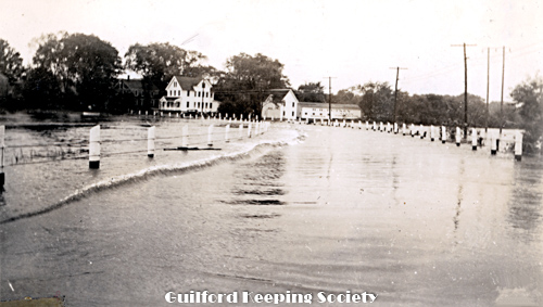
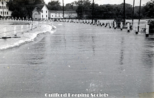
Jones Bridge under water Taken during the hurricane. Route 146 facing west at the bridge over the West River. Sept 21, 1938 BEATRICE OLVER
P-3530.
Cyclone North Guilford Pascal K. Hoadley House SW corner of Rt 80 and Long Hill Rd Sept 1920 Copy negative PC37 From Clarence Potter, see page 3-3 WhyLands album storm Aug 31, 1920.
P-3534.
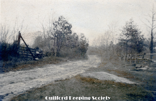
Road from Spencer’s to Hull’s. Probably Dunk Rock Rd ALBERT D. HOTCHKISS.
P-3537.
Hotchkiss lot West side. West Side Cemetery on Three Mile course Rd 1940 ALBERT D. HOTCHKISS.
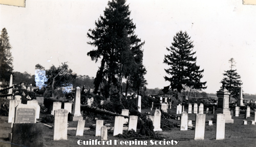
P-3540.
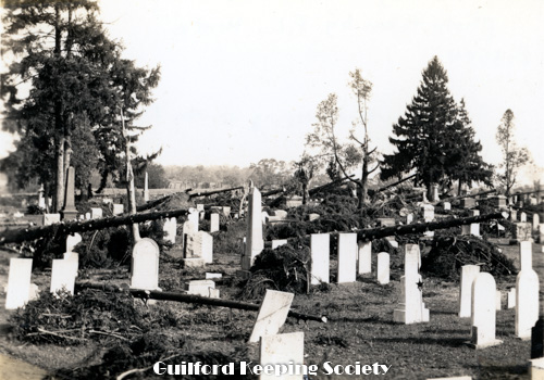
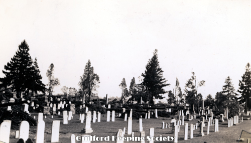
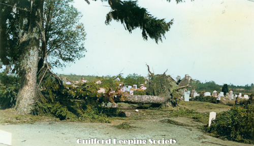
East Cemetery Taken after the hurricane. Alderbrook Cemetery on Boston Street. Oct 1, 1938, F.L. HENTZ.
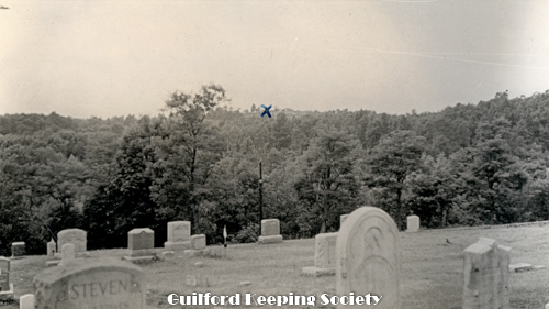
P-3543.
Looking across the lower end of the cemetery from the Church yard. The hill and spot marked with x is Sugar Loaf Hill and the spot where Caleb Fowler lived with his bride Moll C and later with Olive Meigs until leaving for Burton North Guilford Cemetery Ledge Hill Rd facing west. RUTH BENNETT.
P-3546.
East Cemetery from west wall Taken after the hurricane. Looking east Alderbrook Cemetery on Boston Street. Oct 1, 1938 ALBERT D. HOTCHKISS
P-3549.
Hungry Hill S.E. 210 ft. high Sold 1896 C. Hubbard shack at * HENRY S. DAVIS A color photograph.
P-3552.
A color Postcard. Feb. 25, 1954 – Buell 100 ft ? the property to the east of #320 Boston St which Henry Davis sold to Dorothy Buell on Feb. 25, 1954. HENRY S. DAVIS.
P-3555.
Cows grazing.
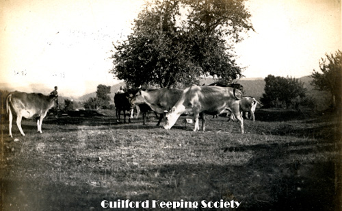
P-3558.
Cows grazing. ? CHARLES D. HUBBARD.
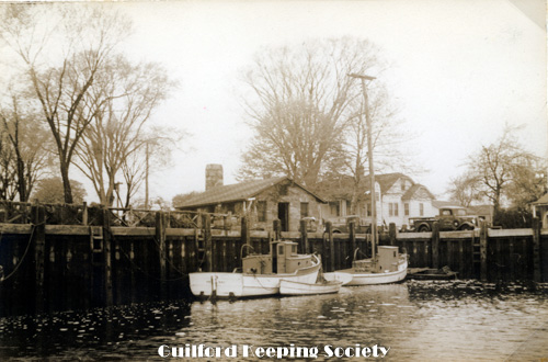
P-3561.
Marina Guilford docks At the southern end of Whitfield Street. The building on the left is presently (1976) the Captain’s Table restaurant. It was a fish market when this picture was taken. DONLEY LUKENS
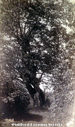
P-3590.
Old basswood tree in garden at Guilford Point Late 1886 HARRIET HUNT BRYAN Another original is in Harriet Hunt Vol. 1.
P-3613.
Richard M. Leete’s house on Moose Hill Rd looking north from Cherry Farm. Cherry Farm is at #172 Moose Hill Rd R.W. Leete’s house May 1885 HARRIET HUNT BRYAN Original in Harriet Hunt Bryan box.
P-3661.
Ninevah Bridge – view from the road. Bridge crosses the Hammonasset River at the border of Madison and Clinton. Pre 1930’s update of bridge HENRY S. DAVIS
P-3677.
Road west side of Lake Quonnipaug North Guilford, Conn. Oct. 1885 Copy of photo owned by Scott Bryan. 1885 HARRIET HUNT BRYAN Original is in Harriet Hunt boxes.
P-3697.
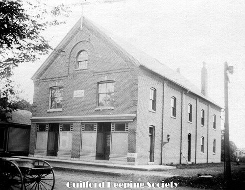
Odd Fellows Hall, south side of Water St Odd Fellows Hall on south side of Water Street. I.O.O.F. and 1894 tablets seen in brick fronting. Doyle’s Floor Surfacing Store presently occupies the ground floor, #14 Water Street. 1897 WILLIAM A. DUDLEY In Redfield Collection.
P-3700.
The Wheel Shop from the Railroad, corner of High and South Fair Streets The Wheel Shop from the Railroad, corner of High and South Fair Streets. Presently the restored brick building owned by CLINIPAD at 6 High Street 1897 WILLIAM A. DUDLEY In Redfield Collection.
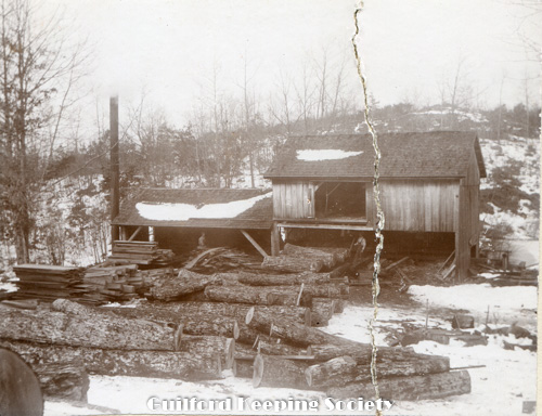
P-3703.
A Guilford Sawmill. Unknown location, but could it be the Parmelee Saw Mill near the Duck Hole Rd before it burned. Henry Parmelee’s sawmill 1897 WILLIAM A. DUDLEY In Redfield Collection.
P-3706.
A view up Fair Street, from just above the foundry A view up Fair Street, looking north, showing Daniel Hand House at 47 Fair St on the far right. 1897 WILLIAM A. DUDLEY In Redfield Collection.
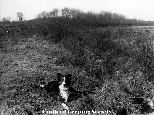
P-3735.
Charles Hubbard’s dog in a field CHARLES D. HUBBARD scrapbook page 6
P-3738.
Robinson House, Nathan Chittenden, West Side Store, Nathaniel Cruttenden house Looking south on North River St toward Rt. 1. Middle house is #1153 Boston Post Rd 1750. House on right was 1161 Boston Post Rd 1752. CHARLES D. HUBBARD scrapbook pg 19.
P-3741.
Town Pound on River St Looking north on River St toward Rt. 1. On the right is 243 River St Joel Collins house 1804. CHARLES D. HUBBARD Charles Hubbard Scrapbook.
P-3744.
Jonathan Bishop house 1787 #191 State St house and barns. Looking South on State St CHARLES D. HUBBARD Negative CDH 146. Charles Hubbard scrapbook pg 23.
P-3747.
George Dudley House 1759 River St . #425 North River St Intersection with North St is on right. Looking North. River St north of Rt. 1 was renamed North River St and given house number in 1960’s CHARLES D. HUBBARD. Charles Hubbard scrapbook p.28.
P-3750.
#1350 Boston Post Rd Charles Fowler Rt. 1, West Side CHARLES D HUBBARD Charles Hubbard scrapbook pg 30. p.20 Hubbard vol. II. Negative CDH 335.
P-3753.
John Collins II House in left rear, House of Jonathan Bishop, Sr. 1787 State St . Foreground #191 State St background #205 State St John Collins II House built 1787. Samuel Blatchley driving his wagon CHARLES D HUBBARD Negative CDH 282 Charles Hubbard scrapbook pg 30. Hubbard album vol. II pg 14.
P-3504.
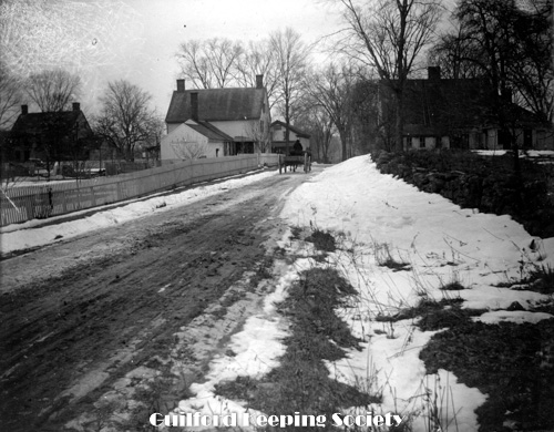
West Side bridges and West River Meadow. Nelson Norton’s left – Henry Bishops right York St and West River facing east. House on the left is #55 York St the Fowler house c1910 ALBERT D. HOTCHKISS
P-3509.
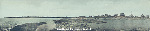
Sachems Head Prospect Avenue
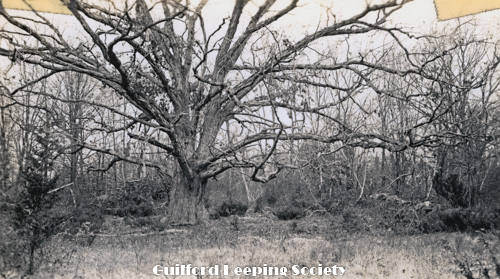
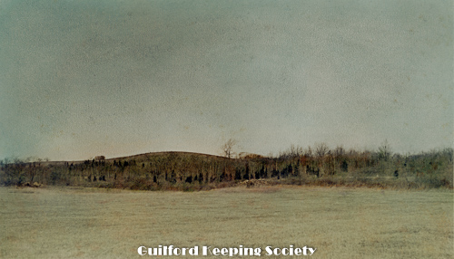
P-3512.
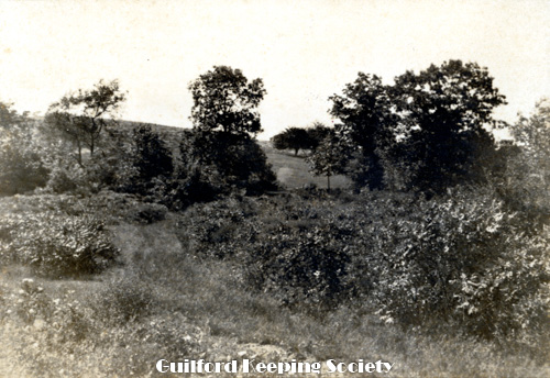
Great oak near Pest Cemetery Clapboard Hill Oct 1938 ALBERT D. HOTCHKISS.
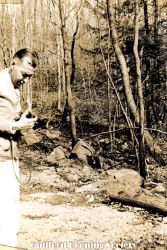
P-3515.
George Olver. Last trip in West Woods Marsh Rd-near Marsh Rd Ledges Spring 1939 BEATRICE OLVER.
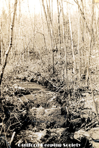
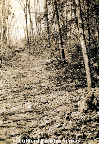
P-3518.
Last trip in West Woods-Marsh Rd near Marsh Rd Ledges Spring 1939 BEATRICE OLVER.
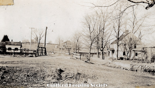
P-3521.
West Side Bridges. Henry Bishop’s house on the left, Nelson Norton’s on the right and Edward Norton’s in the background looking west. #55 York St is on the right, the Andrew Fowler house 1790.
P-3525.
John Benton house (now Short’s) State Street CHARLES D. HUBBARD Negative CDH 39 and CDH 231 (231 better negative exposure).
P-3528.
Jones Bridge under water Taken during the hurricane. Route 146 facing west at the bridge over the West River. Sept 21, 1938 BEATRICE OLVER.
P-3532.
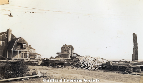
Ruined cottages at Sachems Head After the hurricane. House in center of photo is at the end of Loyal Ledge Rd off Prospect Ave Oct 2, 1938 ALBERT D. HOTCHKISS
P-3535.
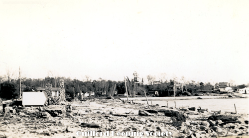
Houses washed from Shell Beach to Main Rd near Dolans Leetes Island Route 146 Taken after the hurricane facing southeast Oct 1, 1938 ALBERT D. HOTCHKISS.
P-3538.
Cyclone North Guilford See also P3529 and 3530 Pascal K. Hoadley house at Southwest corner of Rt. 80 and Long Hill Rd See page 3-3 Why Lands Album and p 2500-203 through p 2500-207 Sept 1920.
P-3541.
Shell Beach Leete’s Island Taken after the hurricane. Facing southeast on Shell Beach Rd Oct 2, 1938 ALBERT D. HOTCHKISS.
P-3544.
East Cemetery Taken after the hurricane. Alderbrook Cemetery on Boston Street. Oct 1, 1938 F.L. HENTZ.
P-3547.
East Cemetery from wall near main gate Taken after the hurricane. Alderbrook Cemetery on Boston Street. Oct 1, 1938, ALBERT D. HOTCHKISS
P-3550.
Hungry Hill 1932 HENRY DAVIS PHOTO. An early color photograph. Probably neg SWD 2616.
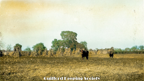
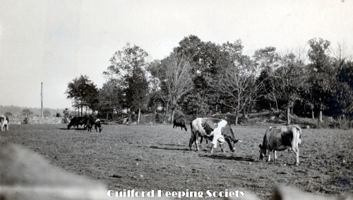
P-3553.
Cows grazing.
P-3556.
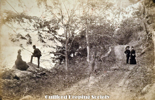
By the shore at Leete’s Island Sachems head Harbor. RUTH BENNETT. Donated by Bob Carder Madison Hist Soc President.
P-3559.
Quonnipaug – looking south. Rustic Inn is on the right. (photo probably by, since his handwriting) HENRY S. DAVIS.
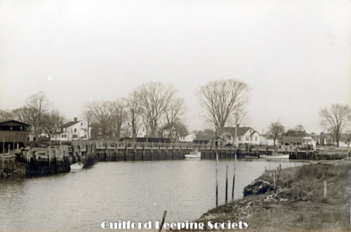
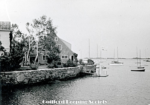
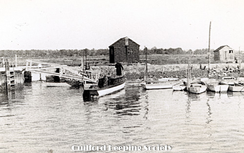
P-3562.
View of the Guilford docks at the southern end of Whitfield Street. DONLEY LUKENS
P-3601.
Andrew Foote House in distance. Looking east on Half Mile Rd toward Goose Lane. The house faces Bearhouse Hill Lane. Colonel George Foote 1810 #829 Goose Lane CHARLES D. HUBBARD.
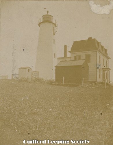
P-3614.
Lighthouse and dwelling on Faulkner’s Island. North side of the island. Earle Leete said that this barn on the right was replaced by a toolhouse. He and his father Edwin used to fish on the nearby island Gull Island and stay overnight here in bad weather. Circa1890-1900 Earle Leetes estimates 1910. Photo by? WEDMORE OR BRYAN
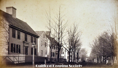
P-3662.
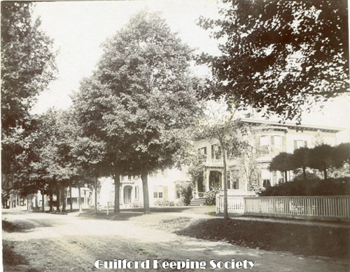
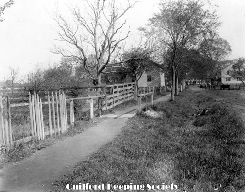
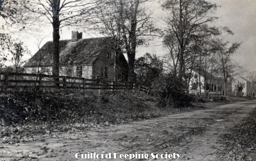
View of Fair St Fair Street, Guilford HARRIET HUNT BRYAN In oversized photo folder. Photostat neg PN 11. Original in Harriet Hunt Bryan box. Gift of David D. Dudley.
P-3688.
Guilford Point House. Seaside Ave. Print from glass plate. Guilford Point 1885 HARRIET HUNT BRYAN Negative HHB1 original is in Harriet Hunt Bryan box.
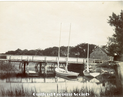
P-3698.
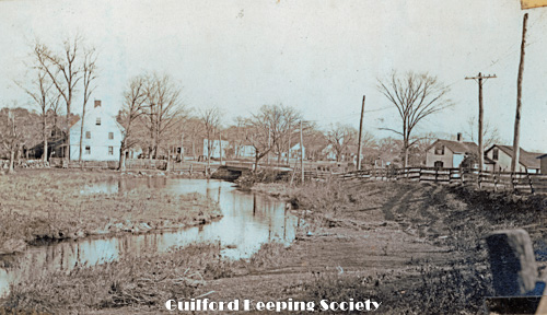
Jones Bridge, south side, Over West River, foot of Water St Jones Bridge over West River, south side, showing small sailboats and Bille Willard House 1897 WILLIAM A. DUDLEY In Redfield Collection.
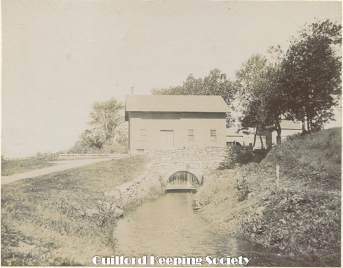
P-3701.
Mill The Town Grist Mill, showing sluice channel. 1897 WILLIAM A. DUDLEY In Redfield Collection.
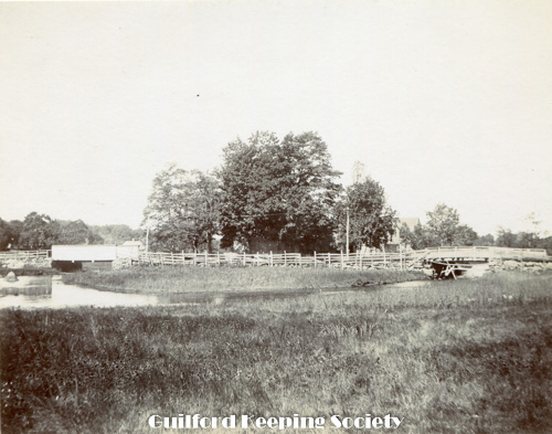
P-3704.
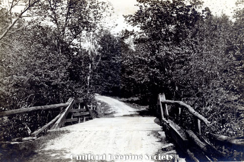
two bridges over steam The West Side Bridges, the next above Jones Bridge, on West River. House on grove of trees is #55 York Street. Looking from south of bridges to north. 1897 WILLIAM A. DUDLEY In Redfield Collection.
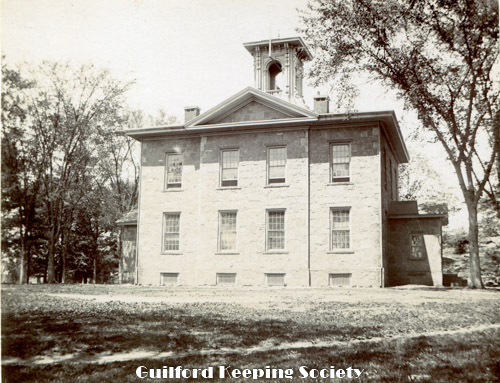
P-3707.
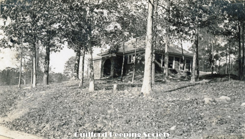
Guilford Institute (High School) The Guilford Institute #120 North Fair St 1897 WILLIAM A. DUDLEY In Redfield Collection.
P-3736.
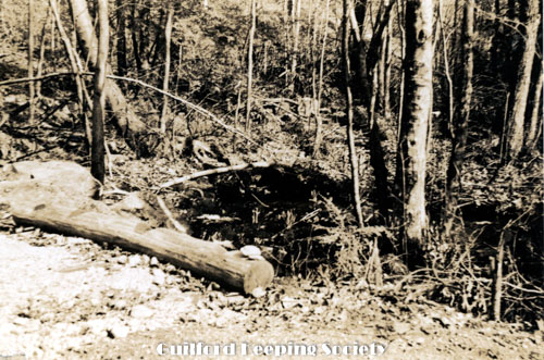
Devil’s Oven in Westwoods CHARLES D. HUBBARD Charles Hubbard scrapbook pg 6.
P-3739.
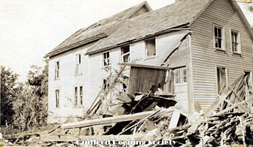
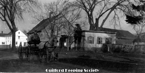
Robinson House 1752, West Side Store and Town Scales. Store was at the corner of Boston Post Rd and River St Looking east on Boston Post Rd West Side Store razed Oct. 1924 (SLT). Robinson house razed May 1937 (SLT). On negative Henry P. Robinson house built for Samuel Robinson Jr. 1752, demolished 1937 and Edwin Griswold’s corner store. Note town scales CHARLES D. HUBBARD
P-3742.
Caleb Benton House 1770 lower Whitfield St #485 Whitfield St Moved from Broad St to make room for 1st Congregational Church in 1829 CHARLES D. HUBBARD pg 12 Hubbard vol. II Charles Hubbard Scrapbook pg 22 negative CDH 317.
P-3745.
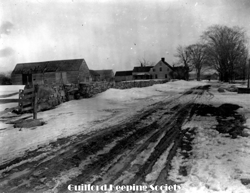
Looking north on Long Hill Rd south of Flat Meadow Rd Former Birchin Farm. Nathan Benton house c. 1790 #749 Long Hill Rd on right. CHARLES D. HUBBARD Charles Hubbard scrapbook pg 26.
P-3748.
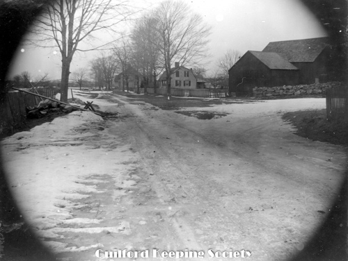
Mary Ann Norton home, on site of Simeon Saxton Hose built in 1790. Linus Saxton house 1803. West Side. Corner of Rt. 1 & Long Hill rd. looking north up Long Hill Rd 2nd house from left is Linus Saxton house 1803 #24. 4 Long Hill Rd CHARLES D HUBBARD Charles Hubbard scrapbook pg 29.
P-3751.
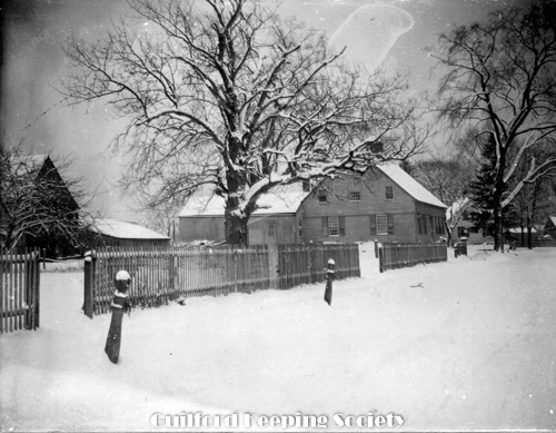
Caleb Dudley III House 1764 Clapboard Hill . #212 Clapboard Hill Rd CHARLES D HUBBARD Charles Hubbard scrapbook pg 30. 1950’s view similar photo negative FLR 91.
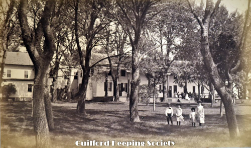
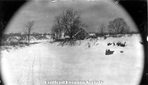
P-3505.
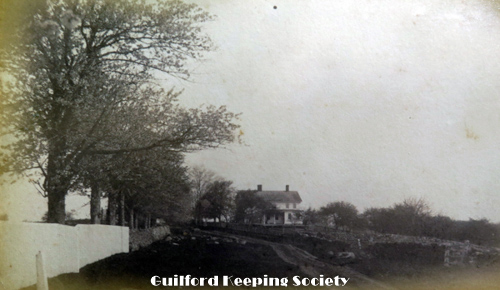
Henry Davis place West side Road to West side Residence of Dad. Walter Bishop Dunk Rock Rd near Route #1 facing west. c1910 ALBERT D. HOTCHKISS.
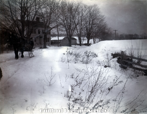
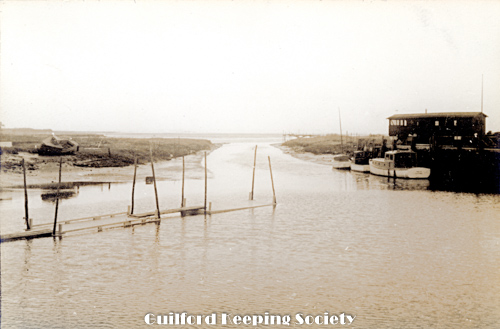
P-3510.
Guilford sluice May 13, 1934, ALBERT D. HOTCHKISS.
P-3513.
Great Oak near Pest House Cemetery Clapboard Hill Oct 1938 ALBERT D. HOTCHKISS

P-3516.
George Olver. Last trip in West Woods Marsh Rd near Marsh Rd Ledges Spring 1939 BEATRICE OLVER.
P-3519.
Last trip in West Woods’-Marsh Rd near Marsh Rd Ledges Spring 1939 BEATRICE OLVER.
P-3522.
York St in front of Robinson place Home of Clarissa Chittenden at right foreground. Frederick Chittenden beyond Looking west to the bridge over West River. Boston Post Rd looing west on far right # #1153 Boston Post Rd Nathan Chittenden.
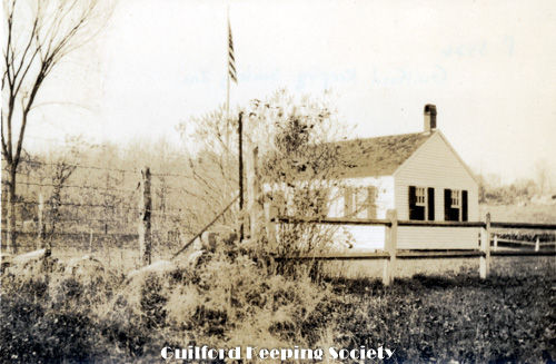
P-3526.
Nut Plains School
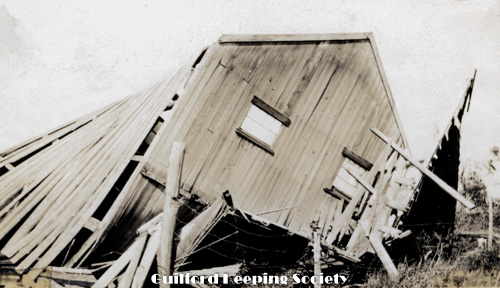
P-3529.
Cyclone North Guilford Pascal K. Hoadley house southwest corner of Rt.80 and Long Hill Rd (Clarence Potter) Storm Aug 31, 1920 Sept 1920 page 3-3 WhyLands album.
P-3533.
State St near Federal Rd Putney house extreme right Beecher house beyond State St near Route 1 looking north. After the hurricane. Sept 22, 1938 ALBERT D. HOTCHKISS.
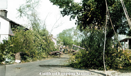
P-3536.
State St Bertha Benton’s at extreme right Taken after the hurricane. #94 State St is on extreme left #93 State St is on the extreme right Sept 22, 1938 ALBERT D. HOTCHKISS .
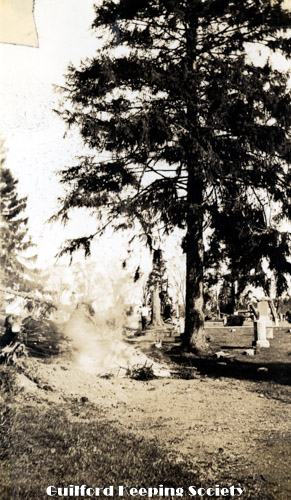
P-3539.
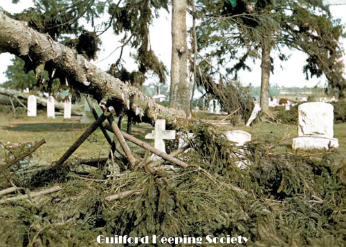
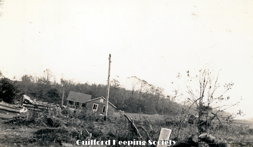
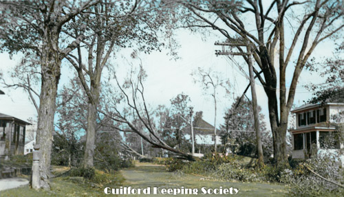
East Cemetery – burning wreckage After hurricane. Alderbrook Cemetery on Boston Street. Oct 7, 1938 ALBERT D. HOTCHKISS.
P-3542.
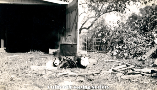
Hubbard’s back yard where we cooked for several days Taken after the hurricane #37 Park Street. Sept 22, 1938 ALBERT D. HOTCHKISS.
P-3545.
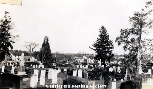
East Cemetery west wall looking NE Taken after hurricane. Alderbrook Cemetery on Boston Street. Oct 1, 1938 ALBERT D. HOTCHKISS.
P-3548.
East Cemetery taken from in front of Fitz Greene Halleck monument Taken after the hurricane. Alderbrook Cemetery on Boston Street. Oct 1, 1938 ALBERT D. HOTCHKISS.
P-3551.
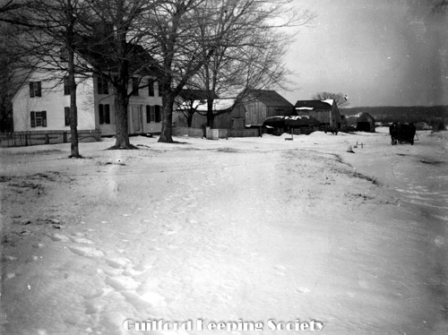
Hungry Hill looking north ? HENRY S. DAVIS.
P-3554.
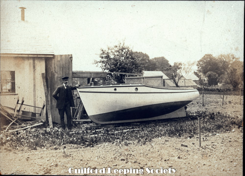
Capt. Louis Anderson builder 20 ft. launch. H.S. Davis owner Henry S, Davis and his boat on Pearl street, where the boat was built. HENRY S. DAVIS Negative HSD 60
P-3557.
Hungry Hill pasture. Signed by Henry S. Davis. Gate to Charles D. Hubbard’s camp is on the left. Looking north on Little Meadow Rd according to Shelton Dudley. 1886.
P-3560.
Boston Post Rd 320 View out the east window of the downstairs SE room at #320 Boston Street, January 24, 1925 HENRY S. DAVIS.
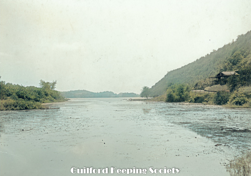
P-3563.
Sluice Looking south out Guilford Harbor from near the sluice. The building on the right is on the left in P3562 DONLEY LUKENS

P-3606.
Cherry Farm on Moose Hill Rd Old Cherry tree and Rex 1886 HARRIET HUNT BRYAN Original in Harriet Hunt Bryan photos.
P-3660.
Mulberry Point and Pipe Bay Guilford, Ct. A triple length 1-cent Postcard, No. 1 Pub. By C.C. Markham, Guilford, Ct. Printed in Germany.
P-3663.
Road was slow bumpy – bump – going to R.R. was no joy ride! Even in Babcock’s 10 cent Rolf & Redfield had a livery stable-__ the trains with a __ 50 cents. Left Meig’s store –. Right Dr. Anderson’s (just the corner). Dr. Falcott – Intellectual & Historical-Dr.’s charged 50 cents for a house call – Had to go to make a call beyond the Conn. River – fell in – broke an axle – so thought we could charge 75 cents! View looking south on Whitfield St Harbor St Guilford HARRIET HUNT BRYAN
P-3696.
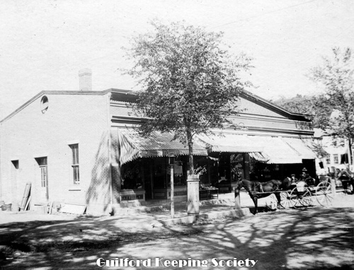
The Brick Block on Water St stands between Hotel and Cannery the Brick Block on Water Street, standing between hotel and cannery. Fruit and fish market sign under front plate windows. Dudley and Beckwith Store presently occupies this commercial building, #11 Water Street. 1897 WILLIAM A. DUDLEY. In Redfield Collection.
P-3699.
Jones Bridge north side showing water or tide gates Jones bridge over West River, north side, showing tide gates and a good view of the Putney House 1897 WILLIAM A. DUDLEY In Redfield Collection.
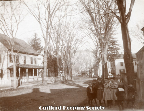
P-3702.
Children downtown roadside Looking eastward along Boston St from the southeast corner of the Green. Group of school children on sidewalk. 1897 WILLIAM A. DUDLEY In Redfield Collection.
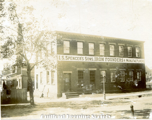
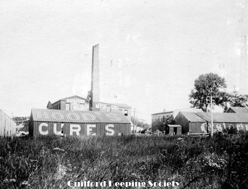
P-3705.
I.S. Spencer’s Iron Founders factory I.S. Spencer’s Sons Iron Foundry on Fair Street 1897 WILLIAM A. DUDLEY In Redfield Collection.
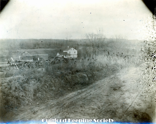
P-3734.
Spring in Beecher Lot, which has been excavated and enlarged to about 100 ft. in diameter to provide water for Fonicello truck gardens. The Beecher Spring is still visible from I-95 northbound, between exits 58 and 59. CHARLES D. HUBBARD scrapbook page 6.
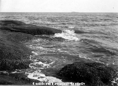
P-3737.
Guilford shore Faulkner’s Island on horizon CHARLES D. HUBBARD scrapbook page 6.
P-3740.
Nathan Meigs House, built 1787 Boston St #254 Boston St CHARLES D. HUBBARD Charles Hubbard scrapbook pg 21. Negative CDH-116.
P-3743.
Ambrose Benton House 1798 State St, Thos. Scranton House 1810. #94 State St in foreground and #110 State St in background CHARLES D. HUBBARD Hubbard book vol. II pg 16 Charles Hubbard scrapbook pg 23. Negative CDH 315.
P-3746.
Looking up West River toward Jones Bridge Looking east from yard of C.D. Blatchley House #218 Water St CHARLES D. HUBBARD CDH 152 Charles Hubbard scrapbook pg 26.
P-3749.
Samuel Hotchkiss House 1819 West Side On left is #161 Dunk Rock Rd Hotchkiss Griswold House built in 1861 CHARLES D HUBBARD Charles Hubbard scrapbook pg 29.
P-3752.
House of Jonathan Bishop, Sr. 1787 State St . #191 State St CHARLES D HUBBARD Pg 14 Hubbard vol. II. Charles Hubbard scrapbook pg 30. Negative CDH 343 very poor, faded.


